
Between Christmas and New Year’s, I led a small group from FTF Engineering on a long day trip to the California North Coast to learn from the December 20, 2022, 6.4 magnitude (Modified Mercalli Intensity VIII, Severe) Ferndale earthquake. Our goal was to visit Scotia, Rio Dell, Ferndale, Eureka, and anything else that caught our eye.
For me, the goal was three-fold: first, to take the opportunity to personally learn something new from a “local” earthquake; secondly, to provide the FTF staff who joined me with their first opportunity to go on what is commonly called an “earthquake chase,” and thirdly, to share our experiences with the broader community in the hope that seismic hazard mitigation will be once again placed in prominent view.
Based on the first press reports, my expectations for learning about building types we design today were low. Still, I have come to understand that in any situation there are always a few nuggets to be found if you look or think hard enough. If you can do what we did after a future earthquake, or any similar natural hazard event, I strongly recommend it. Seeing something up close in the context of the local building inventory and how buildings are or have been generally constructed informs the observer in a way that photographs from recent or long past earthquakes cannot. I assume that engineers in other parts of the country do their own “chasing” after damaging windstorms, floods, fires, or snowfalls. Their experiences do not seem to be as well documented or widely published as for earthquakes, but I wish it were otherwise.
Background
First, I want to provide an overview description of the typical construction, the regional seismicity, and what our team observed.
The North Coast is a large redwood forest stretching north-south from a few hours north of San Francisco to the California-Oregon border and east-west from the coast to the north-south center line of California (roughly Interstate 5). The primary industry has always been and will probably remain lumber. Most buildings are therefore constructed from wood. The local population is largely employed in some aspect of the lumber industry or commerce related to and sustained by the redwood forest, mainly tourism. Except for institutional buildings (hospitals, police stations, telephone exchanges, and so on) and a sprinkling of newer apartment buildings in Eureka (the largest city and main population center), most of the buildings are one and two-story stick-framed or heavy timber structures. Besides Eureka, the next largest city is Ferndale, followed by the smaller towns of Scotia, Rio Dell, Fortuna, and Petrolia. Some of the banking, commercial, and residential buildings in each city are in the grand Victorian style, particularly in Ferndale, dating to the late 1800s (considered old in California). The dairy industry is also significant in the local economy.
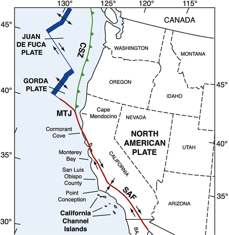
According to the USGS, the area is the most seismically active in California. There have been 40 or so earthquakes over Magnitude 6 in the last 100 years. Most of us know about the “ring of fire,” that tectonic plate boundary circling the Pacific Ocean. The plate boundary along most of coastal California is the famous strike-slip San Andreas fault, see Figure 1. But the part of the ring starting roughly at and running northward from the Oregon-California border is the Cascadia Subduction Zone (thrust fault), where the Pacific plate dips under the North American plate. The melting of the Pacific plate is responsible for the string of volcanoes that start with Mt. Shasta (roughly due east of the Mendocino area) and end with Mt. Rainer near Seattle. Since I won’t pretend to be a seismologist, let’s just say that the location of the transition area, called the Mendocino Triple Junction (where the San Andreas, Cascadia, and the part caught in the middle called the Mendocino Fracture Zone collide) is seismically complicated.
For a bit of recent history, on April 25, 1992, there was a 7.2 magnitude (maximum Modified Mercalli Intensity IX, Violent) earthquake with an epicenter near the small town of Petrolia, located south and west of Ferndale. The main event was followed the next day by two large aftershocks measuring M6.5 and M6.6 on the Richter scale. The total number of aftershocks that followed the main event exceeded 2,000. I visited the area following the earthquake and observed significant damage in Scotia, Petrolia, and Ferndale.
Courtesy of State of California, Department of Conservation.
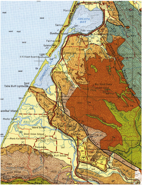
The geologic and site soil conditions always play an essential role in the severity of the ground shaking and any resulting earthquake damage. For non-engineers and earthquake-chasing engineers, it is important to remember that buildings founded on rock generally perform better than those founded on softer and deeper softer soils. This is because these soils magnify the ground motions that buildings “feel.” The mouth of the Eel River, where this earthquake produced the most damage, is in a broad alluvial plain with a deep soil profile (triangularly-shaped pale-yellow area in Figure 2). Ferndale is located on the south side of the alluvial plain, while Rio Dell and Scotia are situated near the east end. Eureka, to the north and southeast of Arcata Bay, has similar soil.
Our Earthquake Chase
Before the trip, we visited the California Strong Motion Instrumentation Program (CSMIP) website and downloaded ground motion and instrumented building data to focus our attention so we could make the most of our trip. CSMIP has placed accelerometers (free field and on buildings) across California so researchers can link observed earthquake damage with the recorded local earthquake ground motions (accelerations, velocities, and displacements). With the recorded data, structural engineers can gauge whether the building codes and standards are targeted properly (too lax or too stringent) at the specific goal of life-safety in all but the most vigorous possible earthquakes. Without the earthquake data, engineers can learn from the observed damage, but like in a car crash, one cannot learn much from the result if the car’s speed is unknown.
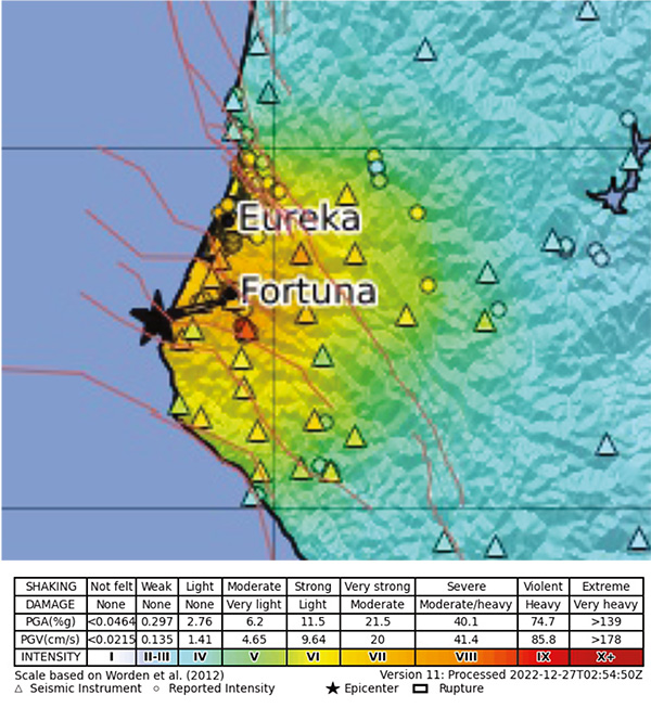
Courtesy of USGS.
The USGS has stated that the recent earthquake occurred in the Mendocino Fracture Zone on a horizontal planar fault. The USGS ShakeMap for the area is shown in Figure 3.
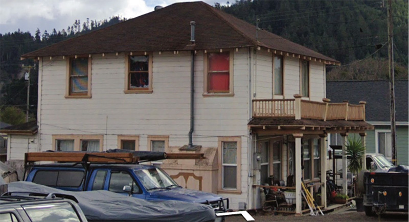
Scotia
We started the day in Scotia (population approximately 1,000). The town’s residential buildings experienced significant damage in 1992, and I wanted to see how they fared this time. Scotia was constructed as a “company town” for the Pacific Lumber Company, with many modest one-story wood homes for workers in the local mill. These buildings are typically elevated above grade, with the first floor supported on wood posts on small concrete footings. The crawl spaces are enclosed with spaced vertical sheathing to allow for ventilation since it rains a lot on the North Coast. The crawl spaces were not braced or minimally braced, creating a soft/weak story condition, and in the 1992 earthquake, many of these homes experienced a collapse in the crawl space. The Scotia homes represent traditional California construction before the advent of concrete slab-on-grade construction, which is predominately used today in mass-produced tract homes.
During our recent visit, we can happily report that we saw no collapses or significant damage. We observed that many buildings had been retrofitted with diagonal wood bracing or are now supported on continuous concrete footings with the plywood sheathing used to brace the crawl space. No doubt a success story for seismic retrofit. We could not find any ground motion data to judge the extent of the success, but a win is a win.
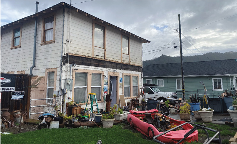
Rio Dell
Just over the Eel River, one mile north of Scotia, is the town of Rio Dell (population approximately 3,400). Rio Dell is a modest community of small, mostly one-story homes, with a few commercial buildings along the main street (Wildwood Avenue), an elementary and middle school, and so on. Rio Dell experienced the most damage we observed on our trip. CSMIP records indicated an Sa at the one second of 0.5g to 0.75g, which is roughly the design force the California Building Code requires for structures in the San Francisco Bay Area that are not located near very active faults. The design requirements for new local buildings are higher, with 2.07g in the 0.3-second period and 1.2g in the one second.
The damage consisted of the following:
i. Houses off foundations and failures of house foundations
ii. Collapse of residential porch covers
iii. Mobile homes off supports
iv. Fallen chimneys
v. Minor structural damage
The damage we observed could have been easily prevented with modest retrofits like those we observed in Scotia. We spoke with a few residents who told us they lacked earthquake insurance because of the high cost (approximately $1,500 per year). It seemed clear that many residents also probably lacked the financial means to make significant home investments. According to the 2000 census, the median household income in Rio Dell was roughly $30,000, with approximately 25% of the population living below the poverty line.
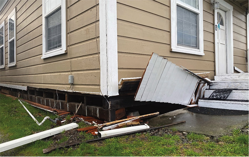
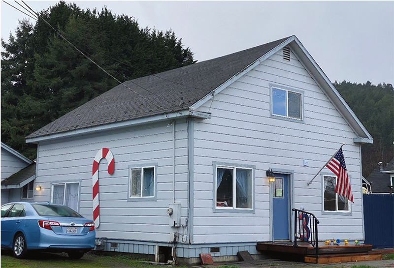
On Painter Street, we observed two nearly identical adjacent homes, one with a retrofitted cripple wall crawl space and one without (see Figures 4, 5A, and 5B respectively). According to the Zillow website, the asking price for similar homes was approximately $330,000.
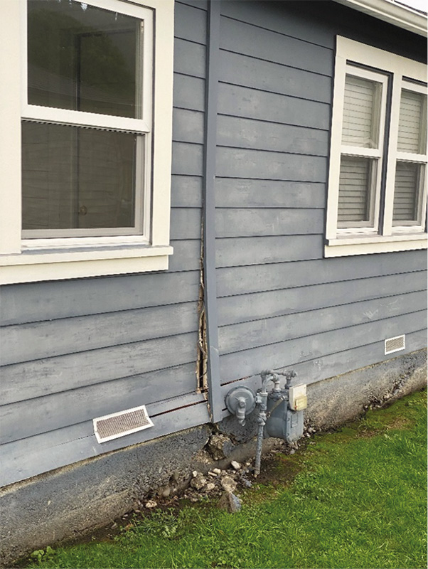
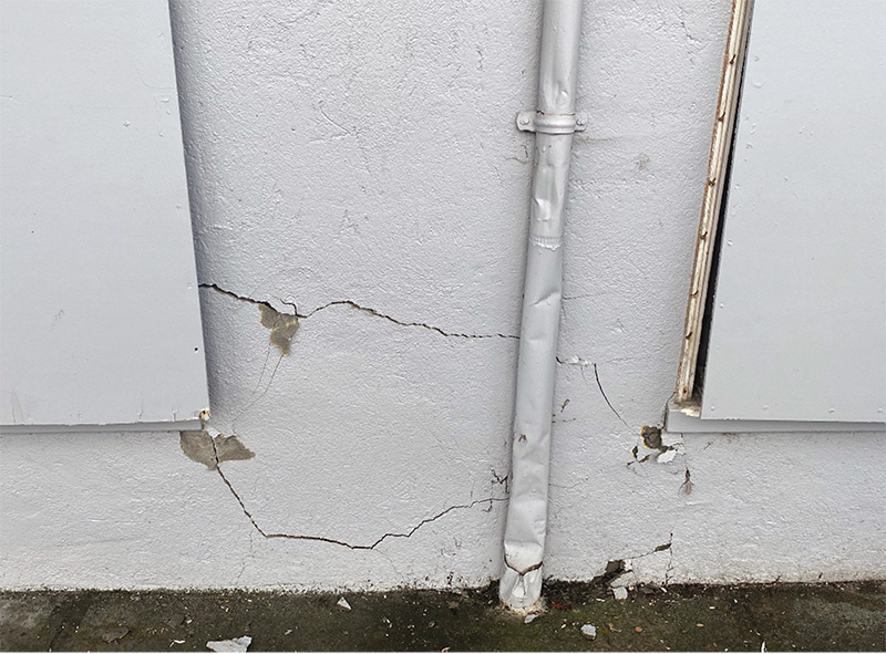
Also, on Painter Street, we observed a home with no apparent damage other than a badly cracked, unreinforced concrete foundation. We are all too aware of the risk associated with unreinforced brick masonry foundations, but low-strength concrete foundations appear to be not much better (see Figures 6A and 6B). The homeowner told us that a contractor had estimated the repair cost at $35,000. Again, using Zillow data, the house value would fall in the $200,000 to $250,000 range. With a 15% deductible based on replacement value for a California Earthquake Authority (CEA) insurance policy, the damage may not be covered or only minimally covered by insurance.
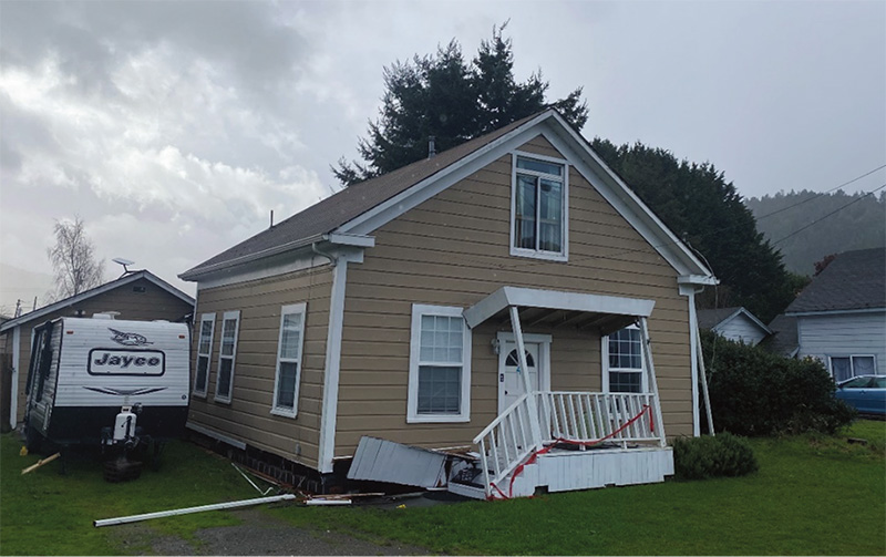
We also spoke with the owner of the now famous home (because of front-page newspaper coverage) on Wildwood Avenue with the collapsed front porch cover (see Figures 7A before and 7B after). He told us that in the 1992 earthquake, the chimney had collapsed and crushed a nearby car. The firebox portion was retained and suffered no damage in the recent earthquake.
The owner invited us inside to have a look around. We could see that the house had been shaken vigorously, resulting in lots of narrow cracks and joint separations. He told us that many items had fallen from shelves. Upon close inspection of the exterior, we could see that the porch cover had been only minimally attached to the exterior wood sheathing. A nominal investment in improving the attachment to the house would have eliminated this significant life-safety hazard.
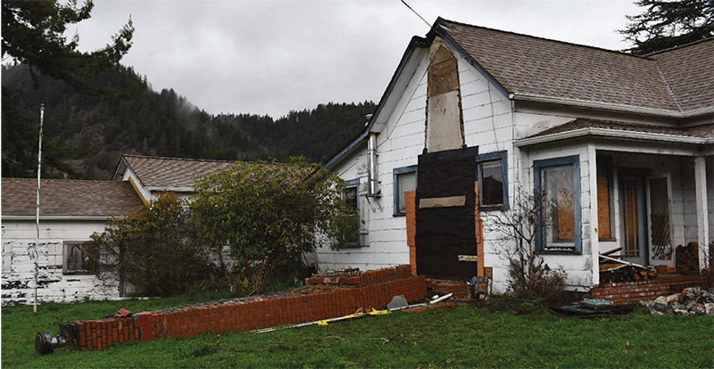
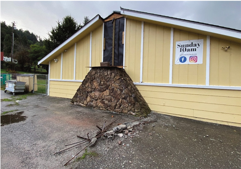
We observed two chimney collapses, one on an older residential structure on Davis Street close to the Eel River (see Figures 8A, 8B, and 8C) and one at a church on Belleview Avenue (see Figure 9).
The Davis Street chimney was very tall, apparently much newer than the house itself, and maybe reinforced. It was minimally attached to the structure and was destined to collapse in an earthquake since the house would not have had the lateral strength to support the chimney.
At the Belleview Avenue location, the chimney was more modern, shorter, and of reinforced CMU block construction. In the debris pile, we saw the reinforcement and straps used to attach it to the structure. But it fell too.
I think it is safe to say that brick chimneys are generally a bad idea for wood buildings. Unless they are designed to be self-supporting, they ought to be removed and replaced with lightweight construction (exterior wood box, triple insulated stainless steel flue, and metal firebox).
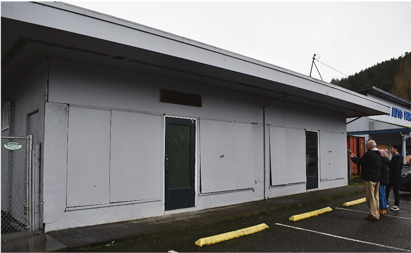
In a testament to the superior performance of reasonably well-designed wood construction, we observed very little damage of a structural nature in Rio Dell. While observing the emergency support services offered at the elementary/middle school on Center Street, we stumbled upon a Napa Auto Parts store and an adjacent former commercial building that was currently part of the school (see Figures 10A and 10B). Before the earthquake, the large plate glass windows had been covered with thin wood panels (we suspect to conceal the storage inside), which were nailed in place with tiny, brad-type nails. During the earthquake, the plate glass broke, the wood panels were loosened with the nails pulling out, and finally, the narrow wall piers resisted the lateral load. The wall piers sustained base rotation and cracked the stucco. We suspect that there were no seismic holddown anchors.
Though obviously not of major significance in the grand scheme of structural engineering, the sequential nature of the structural response was instructive; namely that in smaller events, all of the elements capable of resisting lateral forces (structural and non-structural) will do so, but in increasingly larger events, eventually, it is up to the engineered structural elements to do the heavy lifting.
Ferndale
Next up was Ferndale (population of approximately 1,400). The highway bridge over the Eel River appeared damaged at the abutments. Myers Construction, the specialty contractor often used by Caltrans for the contractor’s ability to accomplish significant tasks quickly, was on the scene. It would have taken more time than we could afford that day to get access, so we decided to skip it but continue to monitor the situation and may report later.
Like Scotia, we can happily report that we saw no signs of significant structural and non-structural damage in Ferndale, except for a few broken windows on the main downtown street. CSMIP records at the Ferndale Fire Station indicated a Sa of 0.73g at the 0.3-second period and 0.4g at the one-second period, which is roughly 75% of the design force the California Building Code requires for the design of new structures in the San Francisco Bay Area not located near very active faults.
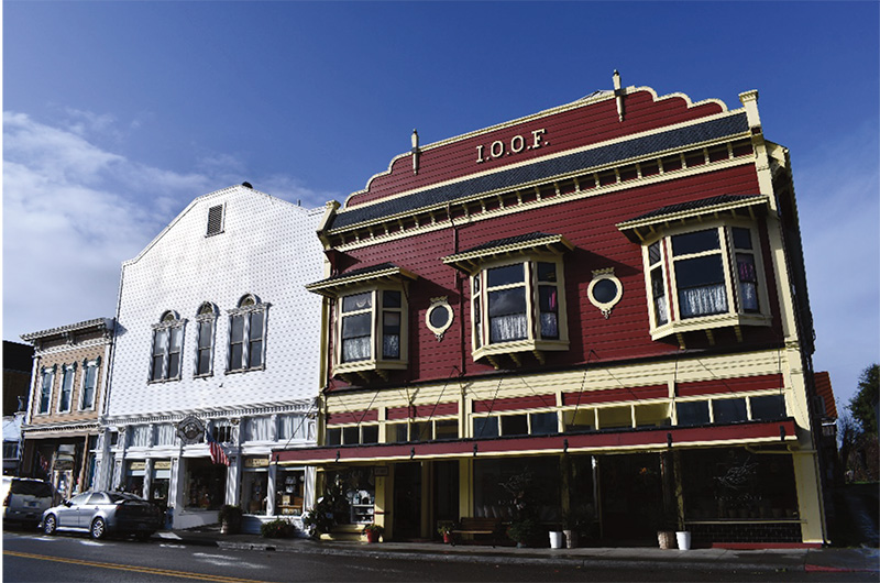
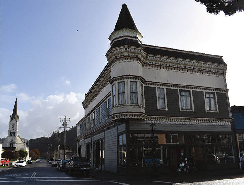
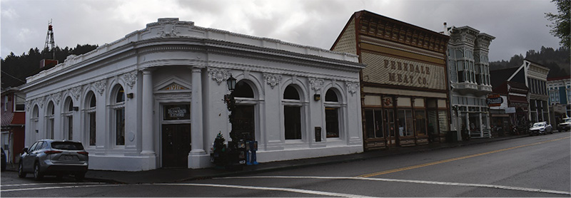
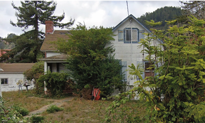
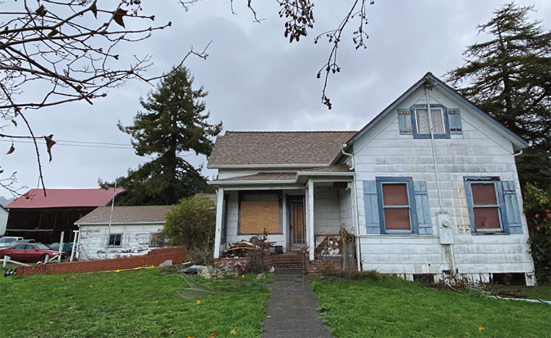
There was extensive damage in Ferndale in the 1992 event, but the repaired residential buildings performed well. As mentioned above, Ferndale has a large inventory of grand Victorian-style construction dating to the late 1880s; see Figures 11A, 11B, and 11C. The commercial buildings are mostly on Main Street, and the residential buildings are located mostly in an adjacent neighborhood to the south and east. Many of the businesses on Main Street were closed for the holidays, so we could not determine the extent of strengthening. However, except for the broken glass, it was difficult to detect signs that a major earthquake had recently occurred. We did not observe modern steel frames and such commonly employed to stiffen the storefronts of commercial buildings. We decided to further investigate the local retrofit ordinances and past retrofit work.
Eureka
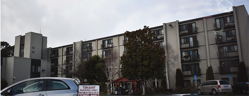
Our final stop was Eureka (a population of approximately 27,000). Based on the press reports, we did not expect to observe much damage. Still, we were intrigued by CSMIP records showing strong ground motions at the instrumented four-story Providence St. Joseph Hospital on Dolbeer Street, and the five-story Silvercrest Senior Housing building on Tydd Street. Both are located on the bluff east of the downtown with firmer soils than in the downtown below on the Eel River floodplain.
CSMIP records at the hospital show a Sa of 0.464g at the 0.3 second period and 0.444g at the one second and the senior housing building with a Sa of 0.859g at the 0.3 second period and 0.239g at the one second period. The design ground motions are 2.27g at the 0.3-second period and 1.23g at one second. We did not observe any damage at either location.
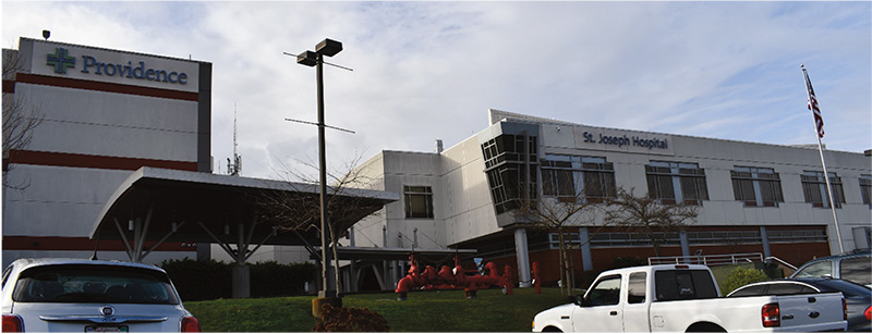
The hospital has an older concrete building on the west and a newer braced-frame steel building on the east, see Figure 12. For the recorded ground motions, we would not have expected any structural damage to the hospital. We also did not see the telltale signs of ongoing repairs to non-structural elements, such as plumbing systems.
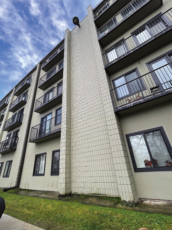
The senior housing was a concrete flat plate building with concrete masonry unit (CMU) columns and flanged CMU shear walls, see Figures 13A and 13B. We walked the entire perimeter and observed no wall cracking.
Conclusions
Given our objectives, we judged the day as a successful learning experience for everyone. As I mentioned at the beginning, take the opportunity to go earthquake chasing if you can. You will likely learn something new. You will also meet the people directly affected by the natural disaster, observe how communities help displaced individuals, and gather your thoughts on how disaster recovery public policy should be crafted.
Our engineering takeaways were:
i. Well-designed seismic retrofits targeting well-known vulnerabilities pay off handsomely. Financial assistance and incentives for retrofits in advance will lessen the impact on communities and improve resilience.
ii. Even moderately strong earthquakes have a way of pointing out to everyone seismic vulnerabilities that are in plain view of people who should know. Communities should encourage continuous mitigation, basically chipping away at a very long list needing attention, rather than waiting for a damaging event.
iii. Regarding protecting life safety, wood frame construction performs well in almost all instances, excepting for the commonly attached masonry chimneys which represent the most significant hazard and should be demolished and replaced in almost all situations.
iv. Admittedly, based on a small sample size in one earthquake, funding from CEA-style 15% deductible insurance coverage may only be available for the largest earthquakes. The more financially prudent approach will likely be proactively retrofitting to address risks from moderately strong and lesser earthquakes. For code-compliant recently constructed homes or well-retrofitted older homes, the repair cost for even the largest earthquakes may be less than one might assume (a good thing). Still, insurance might be worthwhile if it helps to sleep at night.
v. There is a need for seismic vulnerability education and outreach to all populations, but particularly in economically challenged regions. Financial incentives or small investments of public monies to address the most basic of known earthquake hazards would yield great societal benefits.■